I might be putting the cartography before the horse.
Five months ago, I had an idea for a fantasy setting in which the entire planet has been rendered lifeless and inhabitable except for a small region. This largely urban setting, ironically called The Last City of Mirth, has kept its hooks in me for nearly half a year. I’ve already filled 75 pages (26,000+ words) with brainstorming notes.
And by brainstorming, I mean mostly worldbuilding.
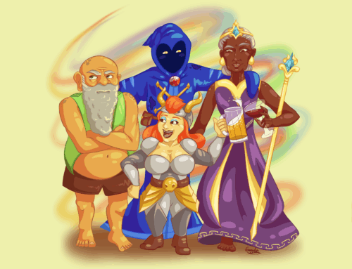
Very early in this potential project, I decided my fantasy world would not have a single elf, dwarf, or even human. Instead, I’ve challenged myself to create eleven unique sapient species to populate the world of Dûr—or at least what remains of it.
Crafting cultures from scratch, detailing everything from physiology and philosophy to education and economy, is a time-consuming exercise. I’ve averaged two species per month and recently reached the halfway point; six down, five to go!
But instead of diving into the fungal, fay-like Mykati, I have temporarily stepped away from biology to embrace a new subject: geography.
Some old-school sketches
Back when I was building Altaerra, my first fantasy world and the setting for The Renegade Chronicles and Magic’s Daughter, I procrastinated when it came to creating a world map.
On second thought, I’m pretty sure I started with a horrible representation of the world that I quickly realized didn’t suit my vision and just as quickly tossed aside. I tried a continent next. Some of those broad strokes were helpful; however, the emerging stories (and backstories) rendered it obsolete in short order.
Focusing in even further, I decided to concentrate on the main setting of my emerging narrative and the book that would eventually become Rebels and Fools. Thus was born this fledgling map of a single island province.

Readers familiar with this region will note a few “inaccuracies,” starting with the spelling of island. “Capricorn” eventually became “Capricon”—and that’s just the tip of the (wizard’s) mountain!
So many locations disappeared after this initial draft, such as Temple of Pymn, Phylins, and Port of Mink. Apparently, Boen Temple was eliminated almost immediately, as evidenced by the enormous, penciled X over its icon. Oddly, Token was also crossed out but survived future drafts. Other destinations, including Aron and Steppt, moved around a bit.
Behold, the second draft:

At this phase, the shape of the land mass itself became standardized; I created a template that I could trace for consistency going forward. The number of locations on the map was also streamlined considerably since the size of the landmass didn’t justify so many settlements.
Yet I needed a different version of the map for The Renegade Chronicles, if for no other reason that Rydah is not in ruins at the beginning!

This map was my must-have reference when plotting the comings and goings of characters throughout the trilogy. Typos aside, it served me well, and it’s what I handed off to the cover designer, who digitized it and cleaned it up.
The final version is what you’ll find in the front of each novel in the series:

What’s interesting to me is the tug-of-war that happens between the story and the map. I couldn’t have gotten through the first draft of Book 1 without a visual representation of the setting. But the words I committed to page also impacted the map, requiring ongoing edits.
I suspect that dynamic is natural, if not unavoidable. Fortunately, technology has made tweaking maps even easier in the intervening years.
Doing digital
None of my subsequent novels necessitated maps. The Soul Sleep Cycle has fantasy flavoring but belongs in the dreampunk genre, and even though Magic’s Daughter is sword-and-sorcery fantasy, most of the story takes place at Castle Nelesti.
An argument might have been made to include a travel map for The Lost Tale of Sir Larpsalot, but I wouldn’t experience the need for cartography until I tackled my first tabletop roleplaying game (TTRP). The Curse of Er’Mah’Gerd required battle maps, local maps, and a regional map.
Here’s the interior of The Winking Cyclops inn from the game’s opening act:

To produce the various maps for The Curse of Er’Mah’Gerd, I familiarized myself with a web app called Inkarnate, which I have also used to craft battle maps for D&D adventures I’ve run for my family—including a couple of one-shots I wrote for Goodman Games.
An avalanche? Ethereal fog? Check and check!

I can’t say, definitively, that The Last City of Mirth will become a TTRPG. Or even a novel for that matter. But as long as I am worldbuilding, I know I’ll need a map before long—hence, this detour from my study of the Mykati mushroom folk.
Let it be known that I didn’t immediately select the digital option for my small regional map. So vividly did I picture some of the geographical features recorded in my 75 pages of worldbuilding notes that I almost convinced myself I had already sketched some rough arrangement of these landmarks.
But like so much of this, it was only in my imagination.
As I considered grabbing one of my decades-old sketchbooks and a mechanical pencil (always a mechanical pencil, 0.5 mm), I paused. In a matter of seconds, I weighed the pros and cons of analog versus digital. For the same reason I prefer to type rather than write longhand, I decided to open my laptop and get to work: deleting and duplicating is far more efficient than manually erasing and repeating.
After nearly four hours—admittedly longer than a smudged hardcopy would have taken but with considerably more polish—I produced the following:
")
The empty village of Prospect didn’t exist prior to this exercise, and I’m not in love with the name. Otherwise, I’m pleased with my efforts. If nothing else, it forced me to name the body of water to the west of Mirth: the Sunswallow Sea.
Now I find myself wondering if the plain between Prospect and Mirth has a name and whether any of the isles near the coast hide additional survivors. Most of all, I’m eager to open a new file and start some urban planning by mapping out the three districts of Mirth.
However, that will have to wait for another day because after the Mykati, a handful of other sapient species await discovery, including nomadic monks with mind-over-matter proclivities, scaled mammalian knowledge seekers, plant-based sprites, and what I can only describe as land squids.
Then I’ll reward myself with a new map—unless some of the characters start talking and distract me in the meantime!

Leave a comment